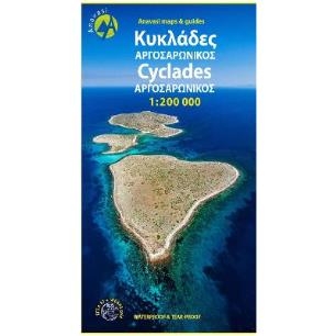
Οδικός χάρτης της Θράκης και των Νησιών του Βορείου Αιγαίου σε κλίμακα 1:230.000Από τη μια πλευρά, η Ανατολική Μακεδονία & Θράκη όπου αρχαία, βυζαντινά και οθωμανικά μνημεία συνυπάρχουν με τα παρθένα δάση της Ροδόπης, πολύτιμους υγροτόπους και το καταφύγιο των αρπακτικών πουλιών της Δαδιάς.Από την άλλη, τα νησιά του Βορείου Αιγαίου: η Θάσος, η Σαμοθράκη, η Λήμνος, η Λέσβος, η Χίος, αλλά και τα...
"Andros is a large island (374 sq km or 147 sq miles), mountainous, with rich vegetation in several parts of the island and abundant running water, as testified by more than 150 watermills. A network of footpaths, many of them between dry-stone walls and several laid with large slate stones, criss-cross the islands hinterland. Several paths are maintained and way-marked. Chora, the main...
"The two maps, Prespa - Mt Varnous - Mt Vitsi, on one side and Mt Voras, on the other, include border areas of Western Macedonia that were until recently off the beaten track. Nowadays these areas have become popular tourism destinations that offer literally everything, from recreation activities and nature attractions to adventure sports, including skiing (there are 3 ski resorts in the...
Νέα έκδοση σε πλαστικό χαρτί, αδιάβροχο και ανθεκτικό στη χρήση. Η κοσμοπολίτικη πρωτεύουσα της Σύρου, η Ερμούπολη κλέβει την παράσταση, όμως το νησί προσφέρει πολλά θέλγητρα για τον περιηγητή και τον πεζοπόρο. Το νότιο τμήμα του είναι εύφορο, πυκνοκατοικημένο και σπαρμένο με ωραίες αμμουδιές, ενώ το βόρειο είναι γυμνό, ανεμόδαρτο και οι θυσαυροί του προσιτοί μόνο στους πεζοπόρους.
Αναλυτικό...
The new map covers the whole mountain range of Lefka Ori from its northern foothills to the Libyan Sea (Sfakia). All the hiking routes that crisscross the mountain (including the E4 trail) are clearly marked on the 1:25.000 map. On the back side of the map there are short descriptions and comments for 15 proposed hiking routes....
"Thasos island is gifted with natural resources and natural beauty. Forests, mineral wealth, marbles and more recently beaches attracted over time people with basic motive the exploitation of its natural wealth. The scars on the landscape are numerous: ancient mining tunnels and holes, ancient towers guarding the coast, mining remnants of the last century, modern quarries, coastal tourist...
"Two very detailed maps (printed on both sides) for Mt Imittos. The first (northern) covers the part of the mountain that extends between Agia Paraskevi and Ilioupoli and from Glyka Nera to Koropi while the second covers all the remaining southern part, between Argyroupoli, Glyfada, Koropi and Vari."...
Το ανατολικότερο από τα βουνά της βόρειας Πελοποννήσου και το δεύτερο σε ύψος του Μωρηά, η Ζήρια είναι ένας τόπος γλυκός και εύφορος.
Μεγάλα οροπέδια και κοιλάδες ποικίλουν το ορεινό τοπίο ενώ γύρω από το βουνό απλώνονται δύο μεγάλες λεκάνες, του Φενεού και της Στυμφαλίας, όπου φωλιάζει και η ομώνυμη λίμνη.
Ο νέος χάρτης της Ανάβασης, σε κλίμακα 1:30.000 και δύο όψεων καλύπτει την...
"Mani is the middle and southernmost peninsula of the Peloponnese and is split between Laconia and Messinia. Exo Mani is the name of the northwestern part, which belongs to the prefecture of Messinia. Exo Mani preserves a treasure trove of Byzantine and post-Byzantine churches and castles in breathtaking landscapes.The new map covers the entire Exo Mani, the are formerly covered by the three...